
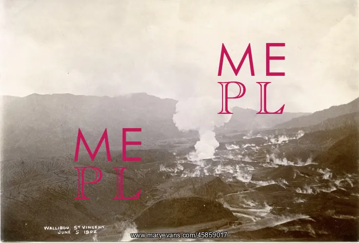
Wallibou, St Vincent
Wallibou, St Vincent, bys Poyer. Wallibou is a village close to La Soufriere, a volcano on the island of St Vincent. The volcano erupted on 7 May 1902, just hours before the eruption of Mount Pelee, on Martinique (an island to the north of St Vincent). The eruption of Mount Pelee is considered to be the worst volcanic disaster of the 20th century. Black and white photograph
Picture No
14154149
Media ID
45859017
Size
1789px x 1212px
(272KB)
Credit
© The Geological Society / Mary Evans
Source
Geological Society of London. Archive reference: LDGSL/1092 - Image reference: 02-21
Date
circa 1902
Pick your License
Considered Disasters Erupted Eruption Eruptions Geological Martinique Pelee Volcanic Volcano Volcanoes Worst
Features In These Collections
> Contributors > GSO



















![Earliest geological map of Ireland [1814]](/sq/800/earliest-geological-map-ireland-1814-48658336.jpg.webp "Earliest geological map of Ireland [1814]")



![Draft of the first geological map of Jersey [c.1828]](/sq/800/draft-first-geological-map-jersey-c1828-48658294.jpg.webp "Draft of the first geological map of Jersey [c.1828]")
![First geological map of Jersey [c.1828]](/sq/800/first-geological-map-jersey-c1828-48658274.jpg.webp "First geological map of Jersey [c.1828]")

![First Geological Map of Scotland [1808]](/sq/800/first-geological-map-scotland-1808-48658245.jpg.webp "First Geological Map of Scotland [1808]")


