
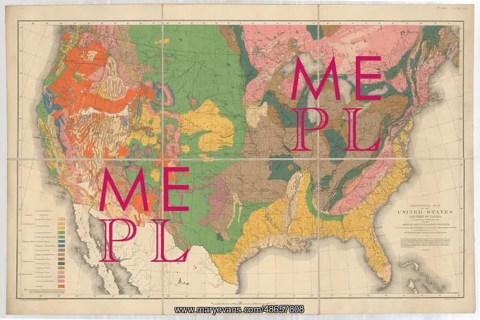
Geological map of the United States and part of Canada
Geological map of the United States and part of Canada compiled. for the American Institute of Mining Engineers to illustrate the schemes of coloration and nomenclature recommended by the International Geological Congress, by Charles H Hitchcock (1836-1919). Map of North America by Charles Hithcock demonstrating new standardisation of geological map colouration. Lithograph and watercolour on paper, dissected and mounted on linen
Picture No
14160576
Media ID
48657808
Size
9111px x 6075px
(12.3MB)
Credit
© The Geological Society / Mary Evans
Source
Geological Society of London - Image reference: 07-107
Date
1886
Pick your License
Coloration Colouration Compiled Demonstrating Dissected Geological Illustrate Linen Nomenclature Recommended Schemes Standardisation
Features In These Collections
> Contributors > GSO






















![Earliest geological map of Ireland [1814]](/sq/800/earliest-geological-map-ireland-1814-48658336.jpg.webp "Earliest geological map of Ireland [1814]")



![Draft of the first geological map of Jersey [c.1828]](/sq/800/draft-first-geological-map-jersey-c1828-48658294.jpg.webp "Draft of the first geological map of Jersey [c.1828]")
![First geological map of Jersey [c.1828]](/sq/800/first-geological-map-jersey-c1828-48658274.jpg.webp "First geological map of Jersey [c.1828]")

![First Geological Map of Scotland [1808]](/sq/800/first-geological-map-scotland-1808-48658245.jpg.webp "First Geological Map of Scotland [1808]")


