
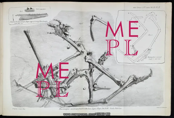
Pterodactylus macronyx
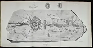
Pterodactylus macronyx found in the Lias, Lyme Regis, December 1828, lithographed by George Scharf after drawing by William Clift. The first British pterosaur was found by Mary Anning (1799-1847) in December 1828. Named by William Buckland (1784-1856) as Pterodactylus macronyx, it is now known as Dimorphodon macronyx (1829 Buckland). Despite missing its head, Buckland estimated the flying creature to be about the size of a raven but closer in resemblance to a modern bat. Lithograph
Picture No
14154647
Media ID
45833122
Size
5319px x 3622px
(3.2MB)
Credit
© The Geological Society / Mary Evans
Source
Geological Society of London. Buckland, W On the Discovery of a New Species of Pterodactyle in the Lias at Lyme Regis', Transactions of the Geological Society of London, Series 2, vol 3 (1829), pp217-222 - Image reference: 27-15
Date
1829
Pick your License
1784-1856 1799-1847 1828 1829 Anning Buckland Clift Closer Despite Dimorphodon Estimated Lias Lithographed Lyme Macronyx Pterodactylus Pterosaur Raven Regis Resemblance Scharf
Features In These Collections
> Contributors > GSO



















![Earliest geological map of Ireland [1814]](/sq/800/earliest-geological-map-ireland-1814-48658336.jpg.webp "Earliest geological map of Ireland [1814]")



![Draft of the first geological map of Jersey [c.1828]](/sq/800/draft-first-geological-map-jersey-c1828-48658294.jpg.webp "Draft of the first geological map of Jersey [c.1828]")
![First geological map of Jersey [c.1828]](/sq/800/first-geological-map-jersey-c1828-48658274.jpg.webp "First geological map of Jersey [c.1828]")

![First Geological Map of Scotland [1808]](/sq/800/first-geological-map-scotland-1808-48658245.jpg.webp "First Geological Map of Scotland [1808]")


